Or Mapping
Advertisement
GPS Converter v.5.2
GPSconverter converts Waypoints, Tracks, and Routes from/to any file format for GPS receiver or mapping program. It also has strong manipulation tools for such data. Note that you can select specific data and convert it among data types (ej:
Advertisement

City Icons v.2013
A collection of glossy icons representing buildings, houses and various objects of city infrastructure, City Icons are here to help design the look and feel of a perfect architectural planning or mapping suite.

Desktop Building Icons for Bada v.2015.1
A collection of 3D icons representing buildings, houses and various architecture objects of city infrastructure, Desktop Building Icons for Bada are here to help design the look and feel of a perfect architectural planning or mapping suite.
Macrobject DObject O/R Mapping Suite
Macrobject DObject suite is an O/R Mapping (Object-Relation Mapping) component package to be used in Borland Delphi. DObject O/R Mapping suite supports a variety of databases and transparent to users and needn't to alter code when switching to different
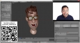
SentiMask SDK Trial v.2.0.193121.9
Real-time 3D face motion capture and tracking SDK for development of augmented reality apps, digital character facial expression control or mapping animated avatars on users face. Works on common PC with webcam or Android smartphone.
TierDeveloper
TierDeveloper is a code generation tool that lets you map and generate .NET business and data objects, ASP.NET apps, and Windows Forms apps. With TierDeveloper, you'll cut down your development time by 50% to 70% depending on your application. Generate
LLBLGen Pro v.3 1
LLBLGen Pro consists of two parts: the LLBLGen Pro designer and the LLBLGen Pro runtime framework.
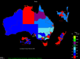
OzGIS v.14.7.0.5
OzGIS is an extensive system for the analysis and display of geographically referenced data. The system can be used to analyze socio-economic and demographic data produced by censuses and surveys and to support management decisions.
GPS Pathfinder Office v.5 20
Powerful and easy to use GPS data processing software The GPS Pathfinder Office software is a powerful and easy-to-use software package of powerful GNSS postprocessing tools, incorporating the new Trimble DeltaPhase differential correction techno
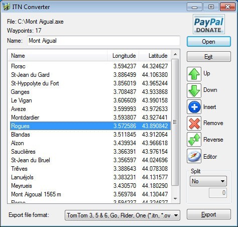
ITN Converter Portable v.1.82
ITN Converter is both a route converter supporting many formats and a simple and efficient route planner.
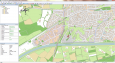
Eye4Software GPS Mapping Studio v.4.1
GPS Mapping Software for Windows, Loading topographic maps, Realtime navigation, GPS position tracking, Map import and export, Coordinate conversion and more